

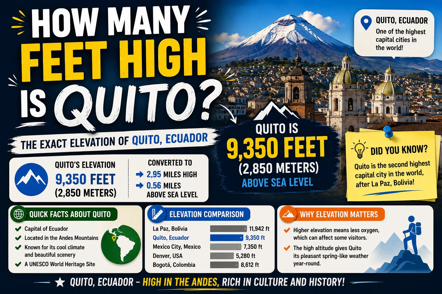
Quito, the capital city of Ecuador, is famous for its breathtaking mountain scenery, rich colonial history, and remarkably high elevation. One of the most common questions travelers ask before visiting is:
How many feet high is Quito?
Quick Answer
Quito sits at an elevation of approximately:
9,350 feet (2,850 meters) above sea level.
This makes Quito one of the highest capital cities in the world.
Because of its altitude, many visitors notice cooler temperatures and thinner air soon after arriving.
Quito’s Official Elevation
| Measurement | Elevation |
|---|---|
| Feet | 9,350 ft |
| Meters | 2,850 m |
Since the city stretches across valleys and hills, elevation varies slightly depending on the neighborhood, but 9,350 feet is the commonly accepted average.
Why Is Quito So High?
Quito lies in the Andes Mountains, one of the world’s longest mountain ranges.
The city is located in a narrow valley surrounded by volcanic peaks, including:
- Pichincha Volcano
- Cotopaxi (visible on clear days)
- Antisana
- Cayambe
Its mountain location gives Quito its unique landscape and climate.
Is Quito the Highest Capital City?
Quito is among the world’s highest national capitals, though not the highest.
| Capital City | Elevation |
| La Paz, Bolivia (administrative capital) | ~11,975 ft |
| Quito, Ecuador | 9,350 ft |
| Bogotá, Colombia | ~8,660 ft |
| Thimphu, Bhutan | ~7,650 ft |
Quito is the highest official constitutional capital city in the world.
What Does 9,350 Feet Feel Like?
At 9,350 feet:
- The air contains less oxygen than at sea level.
- Physical activity may feel more tiring.
- Some travelers experience mild altitude symptoms.
Most healthy visitors adjust within one or two days.
Can You Get Altitude Sickness?
Yes.
Because Quito is over 9,000 feet above sea level, some travelers experience acute mountain sickness (AMS).
Common symptoms include:
- Headache
- Fatigue
- Shortness of breath
- Dizziness
- Nausea
- Difficulty sleeping
Symptoms are usually mild and temporary.
Tips for Adjusting to Quito’s Altitude
To help your body acclimate:
- Drink plenty of water.
- Avoid excessive alcohol on your first day.
- Eat light meals.
- Walk slowly during the first 24 hours.
- Get adequate rest.
- Avoid strenuous exercise immediately after arrival.
If symptoms become severe or worsen, seek medical attention.
Does the Elevation Affect the Weather?
Yes.
Despite being close to the equator, Quito enjoys mild temperatures because of its high elevation.
Typical daytime temperatures range from:
- 60°F to 70°F (16°C to 21°C)
Evenings are much cooler and may drop into the 40s°F (single digits °C).
This pleasant climate has earned Quito the nickname “The City of Eternal Spring.”
How Quito’s Elevation Compares
Here are some familiar locations for comparison:
| Location | Elevation |
| Denver, Colorado | ~5,280 ft |
| Mexico City | ~7,350 ft |
| Bogotá | ~8,660 ft |
| Quito | 9,350 ft |
| Cusco, Peru | ~11,150 ft |
Quito is significantly higher than Denver and Mexico City.
Popular Attractions at High Elevation
Visitors to Quito often explore:
- Historic Old Town (UNESCO World Heritage Site)
- TelefériQo cable car
- El Panecillo
- Mitad del Mundo (Equator Monument)
- Pichincha Volcano
Some attractions are even higher than the city itself.
For example, the TelefériQo takes visitors to elevations exceeding 13,000 feet, where altitude effects can become stronger.
Wildlife and Nature
Quito’s elevation supports unique ecosystems found in the Andes.
Nearby you’ll find:
- Cloud forests
- Highland grasslands (páramo)
- Hummingbirds
- Spectacled bears (in protected areas)
- Andean condors
The surrounding mountains make Quito a popular destination for hiking and nature photography.
Travel Tips
If you’re visiting Quito:
- Pack layers for changing temperatures.
- Use sunscreen—the sun is stronger at high altitude.
- Stay hydrated.
- Bring comfortable walking shoes.
- Allow time to acclimate before mountain excursions.
These simple steps help make your visit more enjoyable.
FAQs
How high is Quito above sea level?
Quito sits at approximately 9,350 feet (2,850 meters) above sea level.
Is Quito higher than Denver?
Yes.
Quito is roughly 4,000 feet higher than Denver.
Is Quito the highest capital city?
Quito is one of the highest capital cities in the world and is widely recognized as the highest constitutional capital.
Can you get altitude sickness in Quito?
Yes.
Some visitors experience mild altitude sickness because of the city’s high elevation.
How long does it take to adjust?
Most travelers adapt within 24–48 hours.
Why isn’t Quito hot if it’s near the equator?
Its high elevation keeps temperatures mild throughout the year.
Is it safe to exercise immediately after arriving?
It’s generally better to take it easy during your first day and gradually increase activity as your body adjusts.
Common Myths
Myth: Quito is always cold.
Fact: Days are usually mild, though mornings and evenings can be cool.
Myth: Everyone gets altitude sickness.
Fact: Many visitors experience no symptoms or only mild discomfort.
Myth: Quito is the highest city in the world.
Fact: Many cities are higher, but Quito is among the highest national capitals.
Quick Facts
- Quito sits 9,350 feet (2,850 meters) above sea level.
- It is one of the world’s highest capital cities.
- The city lies in the Andes Mountains.
- Mild temperatures are caused by elevation rather than latitude.
- Visitors should allow time to acclimate to the altitude.
Final Thoughts
Quito stands at an impressive 9,350 feet (2,850 meters) above sea level, making it one of the highest capital cities on Earth. Its remarkable elevation creates a unique combination of cool weather, spectacular mountain views, and unforgettable travel experiences. Whether you’re exploring its historic center or taking in panoramic views from the surrounding peaks, understanding Quito’s altitude can help you prepare for a safe and enjoyable visit.